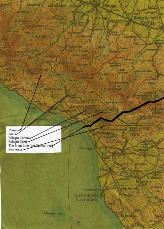
rossano freedom trail : seravezza walk 2007 'operation galia'
Trail report
For Helen
There follows an account of what I believe to be the only completed “ex-filtration” since 1945 along the approximate route that Bob took at the end of Operation Galia. Having done it in perfect weather, I can only describe the Galia effort, in deep snow and extreme cold, as “awesome”. The account is written as part of a draft of a book that I may one day finish. For the meantime, I hope it helps to bring home how magnificent the achievement of Bob and his men was.
september 2007
Rob Hann had heard that I was arranging a walk from Rossano to Seravezza, to try yet again to complete the ex-filtration route of Operation Galia, and he was very keen to come.
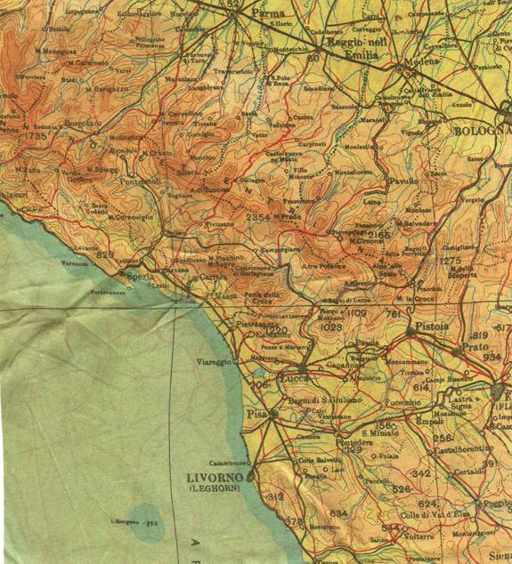
This tough and dangerous freedom trail was much used during the Second World War by escapers seeking to cross the German Gothic Line in Northern Italy in order to reach the safety of Allied lines.
The Gothic Line ran south of the Magra valley, running through the almost impenetrable marble mountains above Sarzana, Massa and Carrara. For escapers arriving from north of the Magra, it was a most demanding challenge.
Nonetheless, between the summer of 1944 and April 1945, hundreds of escapers found their way through with the help of Italian guides. Amongst them, in February 1945, were the men of S.A.S. Operation Galia, led by Captain Bob Walker Brown, and including Stan Hann. They had passed through in two parties, Bob Walker Brown commanding the first, Jim Riccomini commanding the second. Sgt Wright’s stick, which should have included Stan Hann, had gone with Jim Riccomini.
However, I knew from my conversations with Bob Walker Brown that Corporal Johnson, a member of Wright’s stick, had gone with Walker Brown, so it might well have been that the personnel in each stick had become confused by the time that Operation Galia ex-filtrated. In any event, the route would have been roughly the same for each group.
|
The escape trail had twisted and woven its way through enemy positions, changing when necessary from month to month.
My aim was to follow as closely as possible the ex-filtration route used by Operation Galia, which was documented in Bob Walker Brown’s de-brief report. The most important thing, however, [as with the genuine escapers sixty years before] was to get through, and to do the complete the whole route on foot without support vehicles. The details of the precise route were of secondary importance. To the best of my knowledge and belief, until our attempt in September 2007, this trail had not been completed since victory in Italy in 1945. I had tried it twice before, and both those attempts had failed. |
Section of an original parachutist's silk map, showing the operational area of Galia
|
In April 2003, I had organised a very strong party to attempt the trail. Our group of 36 had included 6 “Smiths” from 21 S.A.S. and 18 “Browns” from 23 S.A.S. However, an unexpected heavy fall of snow on the first day of the trail had totally frustrated our attempt, our official guide through the marble mountains was inadequate [she collapsed on day three], and my advance planning proved wholly insufficient to overcome the problems that we faced. We walked no more than sixty percent of the trail.
In May/June 2004, we tried again. This time, we did not have any military participation. Again we encountered snow, but this time only old snow high in the mountains. Again we were beaten, firstly by lack of time on Day 1 when we were carried by motor vehicle from Aulla to Fosdinovo, and then by low cloud on Day 4, when we had to abandon our attempt on Monte Altissimo, and go by road transport to Pasquilio.
Therefore, the objective this year was to choose the best possible month [September] and to go with a small but experienced group. We would travel without any transport or back up crew, and if we failed to complete the trail in four days, we would simply lie up and continue on the fifth. Flexibility was to be the key to success.
Operation Galia had left the valley of Rossano at 15.30 hrs on 10th February 1945, having fought a guerrilla campaign behind German lines since 27th December 1944. They had arrived at the Allied Front line at 04.00hrs on 15th February. They had spent the night of 11th/12th February scouting the area around Aulla in the hope of finding targets, before deciding to ex-filtrate. They had faced heavy snow, trails sown with enemy mines, and enemy action. They had been young and very fit, but also very tired. Most of their travelling had been done at night.
We knew it was possible to do this trek in four days, And although we were nearly all very much older than the men of S.A.S Operation Galia, we would be doing it in daylight and in good September conditions.
Our party was to be led by two Italian guides, both of them top men with whom I had walked before. Emmanuele Fenucci was the President of the Club Alpino Italiano [CAI] in Pontremoli, and an old friend. He would take us across the Magra and on to the village of Vecchieto.
Cesare Codeluppi was the President of CAI Sarzana, and he would take us through the marble mountains to Seravezza. I had walked with him in 2004, and knew how competent he was.
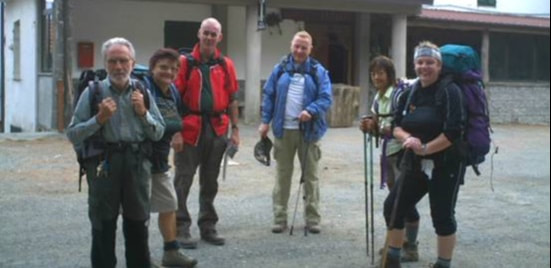
Our party was to be six in number: myself; Tom and Rosemarie MacIntyre [Canadian friends and experienced walkers], Christina, a very fit young Italian [the only youngster in our party]; Paula, an experienced ex Dartmoor Ranger, now working in Florence; and Rob Hann.
Rob had had a hip replacement in January 2007, but he had got himself fit again, and his determination was such that he deserved a chance at the route that his father had taken in 1945. It was to be my final attempt to bring his father’s experiences to life for him.
All of us thought that we knew the difficulty of the task that we faced. We were wrong. It proved to be a lot harder than any of us imagined. Those of us who subsequently completed the trail were left with the utmost respect for those who had crossed in 1944 and 1945 in wholly hostile conditions.
We met up on Sunday 16th September 2007 at the Centro Storico Gordon Lett in Chiesa di Rossano, at about 2,280 feet [702 metres] above sea level. The valley of Rossano had been the gathering point in World War Two for all those who were going to attempt the escape trail, known then as the “ferrovia” or railway.
In May/June 2004, we tried again. This time, we did not have any military participation. Again we encountered snow, but this time only old snow high in the mountains. Again we were beaten, firstly by lack of time on Day 1 when we were carried by motor vehicle from Aulla to Fosdinovo, and then by low cloud on Day 4, when we had to abandon our attempt on Monte Altissimo, and go by road transport to Pasquilio.
Therefore, the objective this year was to choose the best possible month [September] and to go with a small but experienced group. We would travel without any transport or back up crew, and if we failed to complete the trail in four days, we would simply lie up and continue on the fifth. Flexibility was to be the key to success.
Operation Galia had left the valley of Rossano at 15.30 hrs on 10th February 1945, having fought a guerrilla campaign behind German lines since 27th December 1944. They had arrived at the Allied Front line at 04.00hrs on 15th February. They had spent the night of 11th/12th February scouting the area around Aulla in the hope of finding targets, before deciding to ex-filtrate. They had faced heavy snow, trails sown with enemy mines, and enemy action. They had been young and very fit, but also very tired. Most of their travelling had been done at night.
We knew it was possible to do this trek in four days, And although we were nearly all very much older than the men of S.A.S Operation Galia, we would be doing it in daylight and in good September conditions.
Our party was to be led by two Italian guides, both of them top men with whom I had walked before. Emmanuele Fenucci was the President of the Club Alpino Italiano [CAI] in Pontremoli, and an old friend. He would take us across the Magra and on to the village of Vecchieto.
Cesare Codeluppi was the President of CAI Sarzana, and he would take us through the marble mountains to Seravezza. I had walked with him in 2004, and knew how competent he was.
Our party was to be six in number: myself; Tom and Rosemarie MacIntyre [Canadian friends and experienced walkers], Christina, a very fit young Italian [the only youngster in our party]; Paula, an experienced ex Dartmoor Ranger, now working in Florence; and Rob Hann.
Rob had had a hip replacement in January 2007, but he had got himself fit again, and his determination was such that he deserved a chance at the route that his father had taken in 1945. It was to be my final attempt to bring his father’s experiences to life for him.
All of us thought that we knew the difficulty of the task that we faced. We were wrong. It proved to be a lot harder than any of us imagined. Those of us who subsequently completed the trail were left with the utmost respect for those who had crossed in 1944 and 1945 in wholly hostile conditions.
We met up on Sunday 16th September 2007 at the Centro Storico Gordon Lett in Chiesa di Rossano, at about 2,280 feet [702 metres] above sea level. The valley of Rossano had been the gathering point in World War Two for all those who were going to attempt the escape trail, known then as the “ferrovia” or railway.
DAY 1: 17TH SEPTEMBER 2007
Objective: To cross the Magra river and reach the village of Vecchietto
Result: Objective abandoned at 18.15hrs. Night spent in Aulla, two hours short of Vecchietto.
Result: Objective abandoned at 18.15hrs. Night spent in Aulla, two hours short of Vecchietto.
After early heavy rainfall, it was dry when we left the Centro in Rossano, a little later than intended, at 07.15hrs. We carried full packs for four days, save only for food supplies, which we would pick up in main part en route.
Sadly, our party was reduced in number immediately. Christina had been taken ill during the night, and was unfit. She waved to us in her pyjamas from her balcony, and staggered back to bed. Our average age immediately soared! We eventually left the village at 07.20hrs.
So now we were five.
We strolled down through the Rossano villages of Peretola and Valle towards the lower reaches of the valley, before commencing our climb up Monte Picchiara and to the Alta Via [1,021 metres/3,318 feet], along which Napoleon had once marched with his army to invade Italy. I was the guide for this section of the trail, and it was my decision to lead our team up the easiest of the several routes up to the ridge. It was a little further, but hopefully would preserve our energy for the day ahead.
Our climb took us longer than we had hoped, and we eventually reached the top of Monte Picchiara and the ridge of the Alta Via at about 09.20hrs. The hike up had taken us almost exactly two hours. So far we were keeping up with our predecessors.
Here we turned south along the Alta Via over Monte Fiorito [Flower Mountain] towards Aulla and the river Magra. We were to follow the Alta Via for much of the rest of the day. The views to our right would have been magnificent, but low cloud obscured much of the mountain.
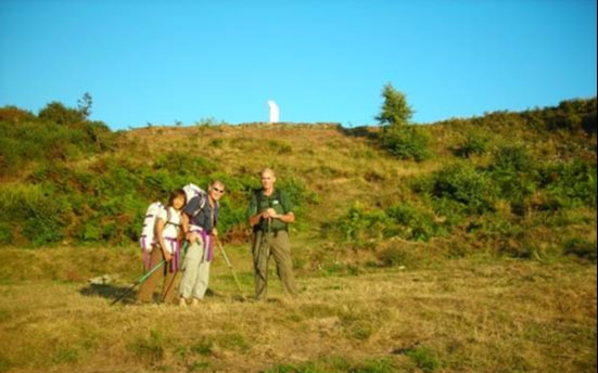
We were due to meet our guide, Emmanuele, at the Hunting Lodge at Casoni at 10.00. In the event, we were about forty minutes late. Emmanuele was due to take us all the way to Vecchietto. There, we would change guides, as Operation Galia had done.
Emmanuele was with his wife, Maria Grazia, another excellent walker, and, after a coffee at the Hunting Lodge, we started off on the long haul down to Aulla.
Sadly, our party was reduced in number immediately. Christina had been taken ill during the night, and was unfit. She waved to us in her pyjamas from her balcony, and staggered back to bed. Our average age immediately soared! We eventually left the village at 07.20hrs.
So now we were five.
We strolled down through the Rossano villages of Peretola and Valle towards the lower reaches of the valley, before commencing our climb up Monte Picchiara and to the Alta Via [1,021 metres/3,318 feet], along which Napoleon had once marched with his army to invade Italy. I was the guide for this section of the trail, and it was my decision to lead our team up the easiest of the several routes up to the ridge. It was a little further, but hopefully would preserve our energy for the day ahead.
Our climb took us longer than we had hoped, and we eventually reached the top of Monte Picchiara and the ridge of the Alta Via at about 09.20hrs. The hike up had taken us almost exactly two hours. So far we were keeping up with our predecessors.
Here we turned south along the Alta Via over Monte Fiorito [Flower Mountain] towards Aulla and the river Magra. We were to follow the Alta Via for much of the rest of the day. The views to our right would have been magnificent, but low cloud obscured much of the mountain.
We were due to meet our guide, Emmanuele, at the Hunting Lodge at Casoni at 10.00. In the event, we were about forty minutes late. Emmanuele was due to take us all the way to Vecchietto. There, we would change guides, as Operation Galia had done.
Emmanuele was with his wife, Maria Grazia, another excellent walker, and, after a coffee at the Hunting Lodge, we started off on the long haul down to Aulla.
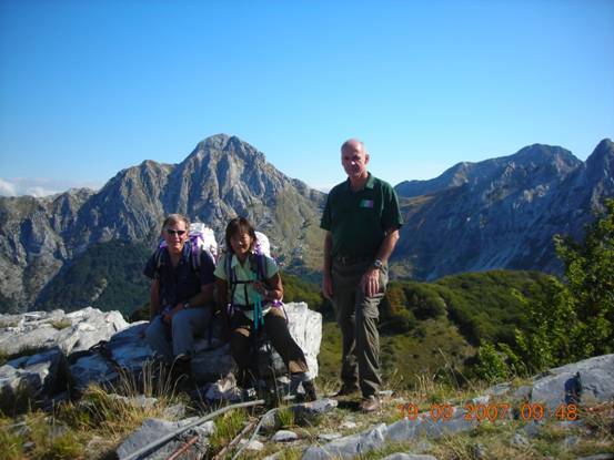
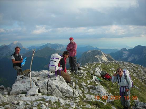
At Casoni, left to right: Emmanuele, Maria Grazia, the author, Rob, Rosemarie, Paula.
We left at 11.00, for what Emmanuele estimated was a six hour walk, and so hoped to be at Aulla by 17.00, and at Vecchietto before 19.00hrs. Daylight would begin to fade soon afterwards, and it would be dark before 20.00hrs. In comparison to February, when Operation Galia had gone this way, there was plenty of daylight, but Galia, of course, had travelled mainly by night.
The going underfoot was smooth and easy, and much of the route was inevitably downhill. However, as the hours went by, our pace began to slow significantly. By 15.00hrs, seven and a half hours into the trail, Paula was in considerable discomfort from a bad hip. We stopped for a few minutes, took her pack from her, and split its contents.
Rob was also suffering. His hip seemed to be going remarkably well, but his feet were badly blistered and were letting him down.
Emmanuele became obviously concerned at our lack of speed. By the time that we crawled into Aulla [300 metres/975 feet], it was 18.15, and I took the decision that we should rest the night there. We would not now have made it to Vecchieto before dark, and some were clearly not going to make it at all. We would rest, and those who were fit enough would go on to Vecchietto in the morning.
Aulla had been a major German garrison town, guarding as it did an important road and rail junction. No self-respecting escaper would have been seen dead in the town! Operation Galia had spent the night in Vecchieto, which was why we were heading there, but we had been frustrated, and had to bivouac where we could.
I telephoned Cesare, our guide for the next three days, and suggested that we should spend the next night at the rifugio at Campo Cecina, which I had visited before,rather than at Vinca. He agreed. We found a reasonably cheap hotel in Aulla, and ate our supper there. It was confirmed that neither Paula nor Rob could go on the next day. Paula’s hip was an old injury which had flared up again. Rob had done remarkably well to hike for eleven hours on his first serious outing with his new hip, but his feet were now in very poor condition. I felt very sorry for Rob, who I knew was determined to go on if he could. However, at least he had experienced at first hand some of the country in which his father had operated.
In hindsight, it was absolutely the right decision that each should stop when they did.
The weather forecast for tomorrow was dreadful.
What was to come was far more tiring, and dangerous, than even I had anticipated.
DAY 2: 18TH SEPTEMBER 2007
Objective: Reach Rifugio Carrara at Campo Cecina [1,300 metres/4,225 feet].
Result: Achieved at 18.30hrs.
Result: Achieved at 18.30hrs.
The three surviving walkers, Tom, Rosemarie and I, started at 07.30hrs, and spent a frustrating first forty minutes trying to find the correct mountain road out of Aulla for Vecchietto. Having finally found it, the spring at which I was due to fill up my water bottle was dry, which completed a perfect start to what, for me, was to be a very bad day!
We were due to meet our guide, Cesare, somewhere on the trail between Vecchietto and Fosdinovo. For the first three hours we were on our own.
Our initial objective, according to the map, was the village of Bibola. This was a fairly stiff walk uphill, although the map told us that we had only climbed up to 376 metres/1,222feet when we reached it after about an hour and a half.
A further twenty minutes took us to Vecchietto, where we filled our water bottles at the village spring, and also made our apologies for our absence the night before. We had very kindly been offered the hospitality of the “canonica” or church guest house, there being no other accommodation in the village. I explained that we had been slowed by injury, and had left two “feriti” [wounded] behind us at Aulla.
I very much regret that we did not spend a night at Vecchieto. As the village monument reminded us, it was an important staging post on the escape route to the front line throughout the war of liberation, and I would have enjoyed spending an evening with the locals. But the important thing was to get through!
We left Vecchietto, climbed up over Monte Boscoletto [590 metres/1,917 feet] and on towards Fosdinovo. We met Cesare at about 11.00hrs, on the Costa dei Cerri. He had brought a cheerful companion with him called Maurizio, who proved to be a skilled and powerful guide, and was also a local historian who knew the Gothic Line fortifications well.
Whereas our guides were fresh, we already had three and a half hours walking under our belts that day, and eleven the previous day.
One of the difficulties that we had was that we had not been able to pick up a packed lunch before leaving Aulla. We had lifted a few emergency rations from the breakfast table, I had some Kendall’s mint cake and Tom and Rosemarie had some energy bars. However, we had been promised a lunch stop at a restaurant on our route. Sadly, when we bypassed Fosdinovo and arrived at the restaurant, we found it closed, and we were only able to buy muffins, crisps, beer and coffee.
However, reading Bob Walker Brown’s report, I noted that when Operation Galia left the area of Aulla on 11th February: “the men carried two days rations only, in the shape of one tin of bully”.Those rations had had to last them until the early morning of 15th February, and they were climbing through mountains covered in heavy snow.
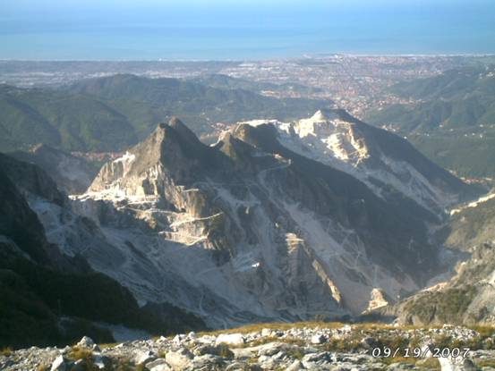
We climbed steadily through the afternoon along what were unexciting paths and roads. Little by little we approached Campo Cecina. My legs felt as if they had settled into auto-pilot. We eventually reached Gabellacia [895 metres/2,908 feet], and began our final climb up Monte Uccelleria to the Rifugio Carrara at Campo Cecina [1,320 metres/4,290 feet]. This is a one and a half to two kilometre climb of 435 metres/1,413 feet], mainly up mule trails. It is here that, for the first time, one begins to see the spectacular character of the marble mountains.
We started this section at about 17.15hrs, in our tenth hour of the day, and twenty-first hour of the trail. I had done it before, in 2004, but then on the morning of a day when we had started from Fosdinovo, and were travelling with light day packs only. Then, I had lost one walker to exhaustion on the way up, and another at the top.
Like all expedition leaders, I have regularly lectured novice walkers on the importance of maintaining your water and salt levels. I am aware also of the need for potassium. But like a fool, on this occasion I had not applied my own rules to myself.
About half way up, I lost all power in my thigh muscles, and very nearly blew up completely. With the encouragement, and tolerance, of my companions I just managed to stagger to the top and into the Rifugio, where I collapsed onto a stool at 18.30hrs. Somebody thrust a glass of mulled wine into my hand, and I began slowly to recover.
Tom and Rosemarie were tired but fine. Tom was proving to be the best walker of the three of us. Rosemarie was to prove that she was probably the toughest mentally. My only consolation was that my feet were fine [or so I thought]. Tom and Rosemarie were not so fortunate.As soon as we were safely in the Rifugio, the weather began to howl around us. We had just made it in time. The forecasted dreadful weather was only just arriving.
The Rifugio Carrara can be reached by road, and therefore is well supplied. It is one of a series of mountain rifugios all over Italy that are run by CAI, and probably one of the best.
We were due to meet our guide, Cesare, somewhere on the trail between Vecchietto and Fosdinovo. For the first three hours we were on our own.
Our initial objective, according to the map, was the village of Bibola. This was a fairly stiff walk uphill, although the map told us that we had only climbed up to 376 metres/1,222feet when we reached it after about an hour and a half.
A further twenty minutes took us to Vecchietto, where we filled our water bottles at the village spring, and also made our apologies for our absence the night before. We had very kindly been offered the hospitality of the “canonica” or church guest house, there being no other accommodation in the village. I explained that we had been slowed by injury, and had left two “feriti” [wounded] behind us at Aulla.
I very much regret that we did not spend a night at Vecchieto. As the village monument reminded us, it was an important staging post on the escape route to the front line throughout the war of liberation, and I would have enjoyed spending an evening with the locals. But the important thing was to get through!
We left Vecchietto, climbed up over Monte Boscoletto [590 metres/1,917 feet] and on towards Fosdinovo. We met Cesare at about 11.00hrs, on the Costa dei Cerri. He had brought a cheerful companion with him called Maurizio, who proved to be a skilled and powerful guide, and was also a local historian who knew the Gothic Line fortifications well.
Whereas our guides were fresh, we already had three and a half hours walking under our belts that day, and eleven the previous day.
One of the difficulties that we had was that we had not been able to pick up a packed lunch before leaving Aulla. We had lifted a few emergency rations from the breakfast table, I had some Kendall’s mint cake and Tom and Rosemarie had some energy bars. However, we had been promised a lunch stop at a restaurant on our route. Sadly, when we bypassed Fosdinovo and arrived at the restaurant, we found it closed, and we were only able to buy muffins, crisps, beer and coffee.
However, reading Bob Walker Brown’s report, I noted that when Operation Galia left the area of Aulla on 11th February: “the men carried two days rations only, in the shape of one tin of bully”.Those rations had had to last them until the early morning of 15th February, and they were climbing through mountains covered in heavy snow.
We climbed steadily through the afternoon along what were unexciting paths and roads. Little by little we approached Campo Cecina. My legs felt as if they had settled into auto-pilot. We eventually reached Gabellacia [895 metres/2,908 feet], and began our final climb up Monte Uccelleria to the Rifugio Carrara at Campo Cecina [1,320 metres/4,290 feet]. This is a one and a half to two kilometre climb of 435 metres/1,413 feet], mainly up mule trails. It is here that, for the first time, one begins to see the spectacular character of the marble mountains.
We started this section at about 17.15hrs, in our tenth hour of the day, and twenty-first hour of the trail. I had done it before, in 2004, but then on the morning of a day when we had started from Fosdinovo, and were travelling with light day packs only. Then, I had lost one walker to exhaustion on the way up, and another at the top.
Like all expedition leaders, I have regularly lectured novice walkers on the importance of maintaining your water and salt levels. I am aware also of the need for potassium. But like a fool, on this occasion I had not applied my own rules to myself.
About half way up, I lost all power in my thigh muscles, and very nearly blew up completely. With the encouragement, and tolerance, of my companions I just managed to stagger to the top and into the Rifugio, where I collapsed onto a stool at 18.30hrs. Somebody thrust a glass of mulled wine into my hand, and I began slowly to recover.
Tom and Rosemarie were tired but fine. Tom was proving to be the best walker of the three of us. Rosemarie was to prove that she was probably the toughest mentally. My only consolation was that my feet were fine [or so I thought]. Tom and Rosemarie were not so fortunate.As soon as we were safely in the Rifugio, the weather began to howl around us. We had just made it in time. The forecasted dreadful weather was only just arriving.
The Rifugio Carrara can be reached by road, and therefore is well supplied. It is one of a series of mountain rifugios all over Italy that are run by CAI, and probably one of the best.
|
After we had all had the benefit of a hot shower [or more accurately a hot dribble since water was in short supply], we sat down to what seemed rather like a family supper beside the woodstove in the bar. The Rifugio is open all year round, and is run by two full time staff, Gianni and his wife Grazia. They were clearly good friends of Cesare’s, whom they referred to as the “boss”, and I noted a certain respect for us when they learned that we had walked from Rossano di Zeri. We had obviously joined the serious walkers club.
Our group of five sat down together with Gianni and Grazia for a splendid four course meal. Gianni insisted on opening three bottles of Spumante and Prosecco, to supplement the red and white wines already on the table. I was reminded of Pippo Siboldi’s feast at Sero, with the Germans all around. As my strength returned, and my spirits rose, I began to realise just how important that meal at the Siboldis must have been to my father and his men, as this was to me. Morale is all important at difficult times, and mine was high by the time that we all went to bed. |
Parachutist map marked with approximate positions and route
|
DAY 3: 19TH SEPTEMBER 2007
Objective: Reach Rifugio Conti [1,425metres/4,631 feet]
Result: Achieved at 19.00hrs
Result: Achieved at 19.00hrs
The plan today was to cut Vinca out of our itinerary, and to cross over the mountains above it towards Monte Tambura, and the Rifugio Conti for our third night. That way, we would not lose too much height. From there, we would be well positioned for an assault upon Monte Altissimo, and the ridge that would eventually lead us down through the Gothic Line to freedom. Cesare, however, retained severe doubts as to whether we could make it to Seravezza by the end of the following day.
The bad weather of the night before had passed over, and the skies were blue. Cesare informed us that the forecast for the next two days was excellent. Tom “the Foot Doctor” had worked on his and Rosemarie’s feet, and my thigh muscles, which had ached all night, seemed somewhat restored. We had now entered the harsh and rugged country of the marble mountains. Incredibly beautiful, I knew from past experience that they were also very inhospitable.
We started at the luxurious hour of 09.00, for what Cesare believed would be a 7-8 hour hike [he was wrong!]. Although we tried to maintain height, as always in the mountains, we were inevitably regularly going up and down. The ground underfoot was always difficult, shale and uneven rock, with only a few breaks where we crossed through small clusters of trees on the sheltered side of the mountains. Much of the day’s trek was closer to rock climbing than walking, with hands regularly in use.
The advantages that we had over Operation Galia were that there was no snow, it was daylight, we had not been fighting a guerrilla war for six weeks, and the paths were not mined.
The disadvantages were that each of us was more than twice the age of the average paratrooper, we were carrying full packs rather just the carbines of a fighting patrol, and the paths that we were using were long out of use, and accordingly fractured and uneven.
We followed the CAI trails numbered 173, 186 and 179. We skirted around beneath the ridge of the awesomely named Monte Razore [Razor Mountain], and then had to climb over Monte Grondilice [1,773 metres/5,762 feet at our crossing point].
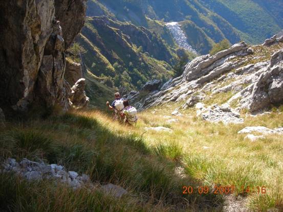
The marble mountains
|
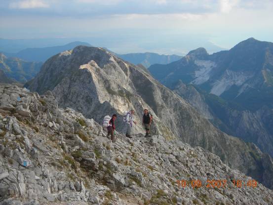
10:48am Day 3. Left to right: Tom, Rosemarie and the author
|
Having crossed over onto the southern side of Monte Grondolice, we paused for our meagre lunch. Mine comprised mint cake, energy bars, crisps [for the salt], biscuits left over from the breakfast table, and a stale muffin. Bully beef began to sound quite appetising!
As we descended from the top of Monte Grondilice, we passed a carving in the rock to our right. I hoped that Rosemarie, in particular, would not notice it, but of course she did. She asked what it was, and I had to tell her that it commemorated a member of CAI who had fallen to his death nearby. These mountains regularly claim lives in modern times.
We seemed to come across a marble quarry on every mountain. The Romans quarried marble here, and the Etruscans before them. The partisans used them extensively too, since the old marble “caves” provided shelter, and were often very inaccessible to the enemy.
As we travelled, Maurizio pointed out many of the old German fortifications, and it was easy to understand why it had taken the Allies so long to break through the Gothic Line.
We passed across the northern faces of Monte Contrario [Unfavourable Mountain] and Monte Cavallo [Horse Mountain] before trekking through the Passo del Focolaccia [1642 metres/5,336 feet] towards our highest objective Monte Tambura.
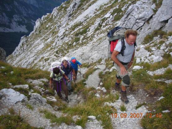
Going up! Maurizio leading, Casare at the rear
|
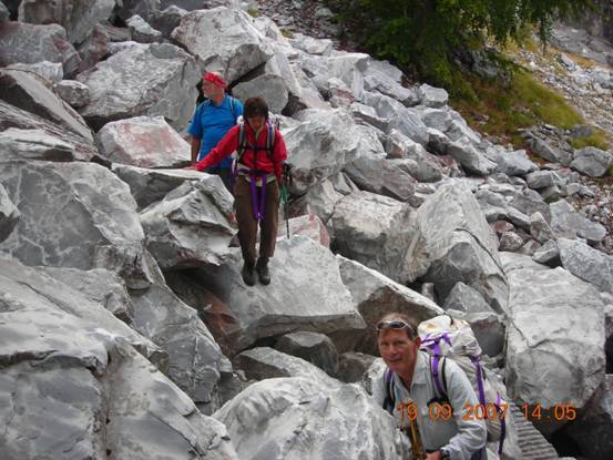
Uneven ground!
|
A tambura is a type of mushroom, and Monte Tambura is so named because it is mushroom shaped. At its summit it is 1,965 metres/6,386 feet high.
The “trail” is marked on the map with a dotted line, indicating that it is regarded as difficult by the expert mountaineers of CAI. Once you have climbed up to the top of the ascending ridge, the “trail” is about 4”-6” wide, and runs along a sharp ridge of unforgiving rock of increasing height. A false step may send you tumbling 300 metres down either side. Both sides are sheer rock.
This was a time to dig deep into our reserves. All three of us were fighting our own private battles by now. The mental effort was enormous, since every step had to be taken with the greatest of care and concentration. A false step could be fatal.
On his retreat up Monte Gottero in the January 1945 rastrallamento, Bob Walker Brown had written that it was necessary to change the man on point every ten minutes. I began to understand why.
We began our final ascent at about 16.15hrs. We were in the eighth hour of our day, and the thirtieth of our trail. Our legs were very tired. At 17.10hrs, we reached the summit.
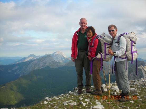
On the summit of Monte Tambura: the author, Rosemarie, Tom
|
On Monte Tambura: Left to Right: Maurizio, Rosemarie, Cesare, Tom
|
It had taken us over 30 hours walking from Rossano.
The day was still fine, and the view was magnificent. Hidden amongst the rocks on the summit is a visitors’ book which we duly signed. I tied a poppy to the pole that marks the mountain’s highest point.
The Galia escapers would not have climbed to the summit of Monte Tambura, they would have worked their way around it. But for us, without the fear of being fired upon, it was the most direct route to take.
The fundamental rule that what goes up has to come down always applies, and, of course, applied to us. The descent from Monte Tambura is probably more dangerous than the ascent, particularly at the end of a long day. A false step going down could even more easily lead to a fall down the steeps sides of the ridge.
I had the advantage of having done it once before, and knew that although my knees would demand that I do it very slowly, I would make it down.
For Rosemarie and Tom, doing it for the first time, I suspect that it was a very tough indeed – but, as always, they just got on with it.
Going down!
|
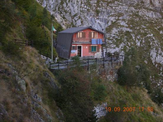
The Rifugio Conti
|
Once we had dropped down a thousand feet, the trail became easier. We now only had to walk around and down the side of Monte Focoletta to reach the sanctuary of the Rifugio Conti, a remote Rifugio many kilometres from the nearest road. Having left the summit of Monte Tambura at about 17.30 hrs, we reached Rifugio Conti at almost exactly 19.00hrs. With our tired legs, Cesare’s estimate of 7/8 hours had become 10. Our trail had now taken 32 hours. But we were safely there.
The Rifugio Conti is a totally different sort of hostel to the Rifugio Carrara. It can only be reached by a three hour walk from the nearest road. It is supplied by helicopter to a very small landing field on the side of the mountain, and as a result the Rifugio is adequate but basic. There were no showers available because of a water shortage.
I again noted a certain respect towards us from our hosts at the Rifugio Conti. Rossano seemed a long way away both to them and to us.
As the only serious walkers present, we were given a small dormitory of our own. Four beds, one mattress on the floor.
We ate all that the Rifugio Conti could give us, drank a little, and all five of us were in bed by 21.20hrs. In the subsequent Snoring Olympics, Italy took the Gold and the Silver, and Canada took the Bronze!
DAY 4: 20TH SEPTEMBER 2007
Objective: To cross the Gothic Line and to arrive behind the Allied Lines at Seravezza
Result: Objective achieved, after dark, at 20.30hrs
Result: Objective achieved, after dark, at 20.30hrs
Cesare did not believe that we could make it to Seravezza today. We had talked about it last night. Even in 2004, Cesare had said it was too far, and then he had been proved right by the weather. The forecast for today was very good, and I had suggested that if it was too difficult, we should make it to Pasquilio, and then on the 5th day, when the guides were not due to be with us, I knew the route down to Seravezza well enough to take our group there.
When I suggested that, Maurizio had said that if we were to get as far as Pasquilio, then we might as well finish, since it was only another two hours to Seravezza. Cesare agreed.
They thought that the day would take a minimum of eleven hours.
We were all tired, with the possible exception of Maurizio. We were still carrying our full packs. I thought back to Bob Walker Brown’s report. Before crossing Monte Grondolice [our Day 3], he had written that they had left their Bren guns with the partisans, because it was not possible to carry them further owing to the physical condition of the men.
Before crossing Monte Altissimo [our Day 4] they had dumped their rucksacks, and had proceeded; “carrying only carbines and reserve ammunition…decided to move through as a fighting patrol and reach the Allied positions at all costs. March over Monte Altissimo was exceedingly difficult and tiring. It was pitch black, and not possible to use the ordinary mountain track as it was mined. 2,000 feet or more had to be climbed at an average slope of 1 in 4.”
Whatever else, at least we did not have mines to contend with, or at least we hoped that they had been cleared by now!
We left at 08.00hrs, having eaten our most basic breakfast yet. Cesare had promised that we would be able to pick up lunch at a mountain restaurant on the way. However his track record for open restaurants en route was not good! Our emergency rations were running low.
Cesare had clearly decided that if we were going to succeed, we must really go for it. There is an easy way up to the top of Monte Focoletta that we had taken in 2004. That was not for us today. We went straight up the side of the mountain above Rifugio Conti, using our hands to climb up the crags, forcing our aching limbs into action. There is no trail that I could find marked on the map for this route! From 1,425 metres we clambered up to 1,600 metres, a climb of over 500 feet. We then cut across the ridge to pick up a well used trail down the other side of the mountain. As is the way in the mountains, we now lost the height that we had just worked so hard to gain.
The path that we followed down had once been a fine road. Maurizio told us that it had been built in the middle ages to connect the city of Massa with the city of Modena, after the ruling families had allied themselves by marriage. We dropped down to about 1,100 metres/3,575 feet, only to face another climb up of 400 metres, over Monte Sella, through the Passo di Sella. We followed an old winding mule trail for what seemed to me like a very long time, and finally reached the top of the pass [1,500 metres/4,875 feet]. Tom was easily the first to the top, I was easily the last. Every step was hurting me now, even though I had made sure that I had maintained a sufficient water, salt and potassium level since the near disaster of the second day. I was suffering. I suspect that the same was true for Tom and Rosemarie – their feet had been giving them trouble since an early stage. But as so often with endurance events of this kind, there were no complaints. We just got on with it.
At the top of the Passo di Sella, just to cheer us up, there is a series of crosses to commemorate the lives of the climbers and walkers that the mountains have claimed over the years.
It was about 11.00hrs, and Cesare told me that we had already fallen behind our timetable. He was eager that we rest for no more than five minutes. And so we moved on.
In 2004, it was at this point that clouds had come down, and Cesare had insisted that we drop down to the village of Arni, telling us that it was too dangerous to continue on our chosen route. We were about to find out why.
The weather was perfect, and we began to work our way carefully around the south eastern face of the next mountain, Monte Macina, retaining a height of just under 1,400 metres. There was almost continuously a sheer drop below us, and the path was better suited to goats than humans. Every step had to be chosen with extreme care, and what little conversation we had been having over the past few hours now dried up completely. We used our hands regularly.
We made our way past an out crop of the mountain colourfully named Chiesa del Diavolo [Church of the Devil], and finally began our descent towards Le Gobbie [1,037 metres/3,370 feet] in the pass that runs to the north of our final obstacle, Monte Altissimo [Very High Mountain].
The names of some of these mountains spoke for themselves. In choosing the names Razor Mountain, Unfavourable Mountain, Church of the Devil, Very High Mountain, the old Italians were obviously warning their successors of the difficulties of a crossing on foot!
We arrived at Le Gobbie at 13.45hrs. It was here that we found the restaurant of which Cesare had spoken. Miraculously, it was open. I asked Cesare how much time we could spend here. He said only fifteen minutes, because we were running very late.
However, we were by now all very tired. I knew that we had the climb over Monte Altissimo to come. I remembered the words of Bob Walker Brown: “the march over Monte Altissimo was exceedingly difficult and tiring.” I decided for the first time to override the advice of our guides. We entered the restaurant, and I asked what hot food they could serve us with as quickly as possible. Fifteen minutes later, we had five steaming plates of tegliatelle ai funghi in front of us. At 14.15 hrs, we marched off from the restaurant feeling a lot better. Graciously, both Cesare and Maurizio were later to say that stopping to eat our plates of hot pasta had been a very worthwhile decision.
We now faced the first phase of the assault on Monte Altissimo. This comprised a long climb up an old mule trail to the Passo degli Lincini at 1,407 metres/4,572 feet, so another 1,200 feet up! However, the pasta had a remarkable effect upon our strength, stamina and morale, and we made our way to the top of the pass at good speed.
The advantage to the walker of the old mule trails is that they wind up the mountain gradually, rather than go straight up the 1 in 4 incline of which Bob Walker Brown complained in his de-brief report. Nonetheless, the few hours that followed were, for me at least, unmitigated hell!
Passo degli Licini, Monte Altissimo
|
The "funnel descent" on Monte Altissimo
|
My mind went back again to Bob Walker Brown’s report. When, on the 11th February, they had abandoned further action against the enemy, and had decided to ex-filtrate, one of the reasons Bob had given for his decision was that: “the medical officer had advised that the men were exceedingly tired.” That had been before they had even started. Feeling the fatigue that I did on Monte Altissimo, I began to understand properly for the first time the real achievements of Operation Galia.
As everybody knows, the danger of very tired legs is that you make mistakes. If any of us had made a mistake on this section of our climb, again we would have paid a serious penalty. So we moved slowly and with great care, climbing along the ridge, and over numerous outcrops of rock.
We toiled for about three hours, making our way from Monte Altissimo towards Monte Focoraccia [1,149 metres/3,734 feet] until we finally arrived at a point that I recognised, and had visited before. It was a small monument to two partisans captured and shot by the Germans in February 1944. From there, I knew that we were safe, and that the trail would become easier. It was about 17.00hrs, and after 41 hours of walking, I was finally sure that we were going to make it, albeit not before dark. I felt something of the elation that the men of Operation Galia must have felt when they finally crossed through the Allied front line.
After a final short climb, we began our descent along the grassy pastures of the north west face of Monte Focoraccia. Our pace increased as the going became very much easier. We could sense the finishing line.
At about 18.00hrs we reached the vicinity of Pasquilio [827 metres/2,687 feet], and at 18.30hrs finally crossed the front line, passing by the monument to the Gothic Line on the ridge above us.
Crossing the Front Line: Rosemarie, Tom, the author
For the first time in two days, I found that I had a signal on my mobile telephone, albeit the battery was nearly dead. I was reminded of the problems that Operation Galia had had with their radios. Communications had been so bad that halfway through the operation, HQ in Florence had sent a man, Sgt Guscott, up through the lines to find out what was going on in the Rossano Valley. Picking up my voicemail, I discovered that Rob Hann had been looking for us for two days, and had come by road to Pasquilio the night before. He had hoped to join us after lunch on the last leg to Seravezza. The original hope had been that we would arrive at Pasquilio in the early afternoon. Rob’s last message told me, that, having failed to find us, he had returned by road to Rossano.
Now, for us, began the final race to Seravezza. From this point it normally takes about two and a half hours to get there. We had an absolute maximum of one and a half hours of daylight. It was time to use the very last of our reserves.
Cesare took the lead. He had been back marker over the mountain ridges, with the physically stronger Maurizio at the front. Now, Cesare showed a real urgency to get home, covering the descending slopes at what was, to my tired legs, an extraordinary speed. Surprisingly, we did not fall too far behind. We strode on down the trail, passing by the little chapel of Cereta San Nicola where we picked up fresh water at the spring. At about 19.50, in what was for me easily a record time, we arrived at the final descent to Seravezza, known to us as the infamous “Staircase of Death”. This is an ancient, cobbled mule trail that descends steeply from the trail above directly down to the town of Seravezza. It is a drop from 400 metres to 50 metres [a total of 1,137 feet], and it has always proved to be extremely painful on the knees. The consolation was that when suffering the pain, we knew that this truly was the final descent.
When we reached the top of the staircase it was almost completely dark. The descent would take about forty minutes. We started down slowly, at first making the most of the ambient light, and then finally turning on the torches that we were carrying. We arrived at the bottom at 20.30hrs.
Waiting for us in the town square were Serena Deluchi and Dr Piersandro Bonomi, her fiancée. They had come to carry us back to civilisation!
Our journey had taken us forty-four hours and fifteen minutes, spread over four long days. On my third attempt at this trail, we had finally completed it. Out of a total, over the years, of fifty-five people of varying abilities who had come with me, three had finally done it, undoubtedly for the first time since 1945. Two Canadians and a Brit had finally got through!